Finnish swimming places on the map
Uimarannat is an iOS app that shows Finnish public beaches and swimming sites on National Land Survey maps. The app combines data from open sources into a clear map view.
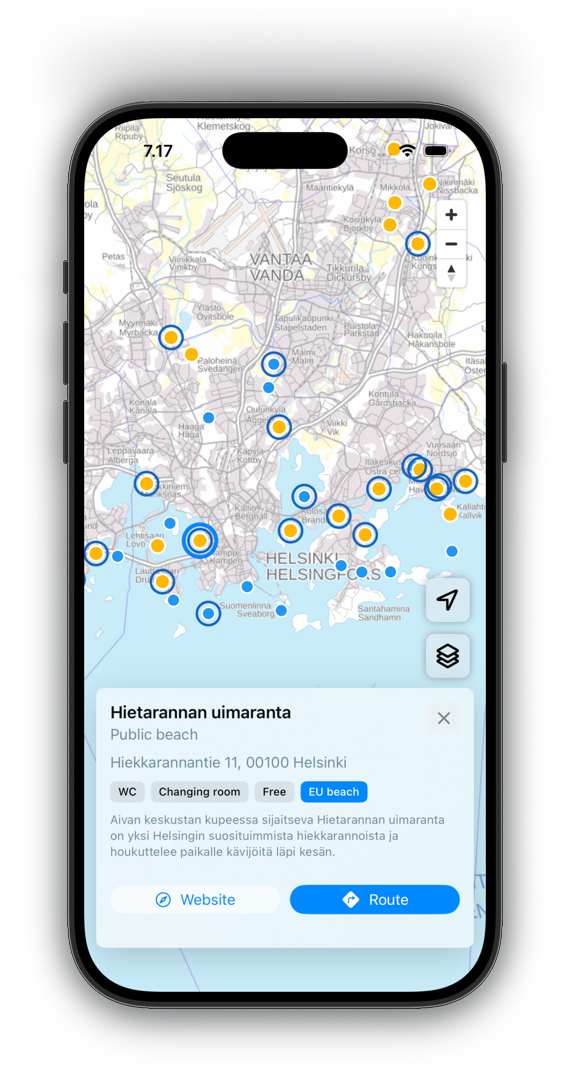
Features
Over 2,000 swimming places across Finland
Three base maps: background map, terrain map, and simplified map
EU Bathing Water Directive beaches marked separately
Site details, amenities, and directions.
Interface in Finnish, Swedish, and English
Privacy Policy
Uimarannat does not collect, store, or transmit any personal data. The app uses no analytics, cookies, or third-party tracking.
Location data is used only locally to center the map and is never sent to any server. Location permission can be denied without affecting the app's other functionality.
Disclaimer
The information in this app may be incomplete or inaccurate. The developer assumes no responsibility for the accuracy of the data. Always verify information from official sources.
Support
Contact: support @ multiweek . app
Kartta-aineisto © Maanmittauslaitos (CC BY 4.0) · Uimapaikkatiedot © LIPAS / Jyväskylän yliopisto (CC BY 4.0) · EU-uimavesitiedot © SYKE (CC BY 4.0) · MapLibre GL JS (BSD-3-Clause)